When Cities Grow Inward
Growth, Stewardship, and the Changing Shape of Raleigh

By Jeff Havener
March 2026
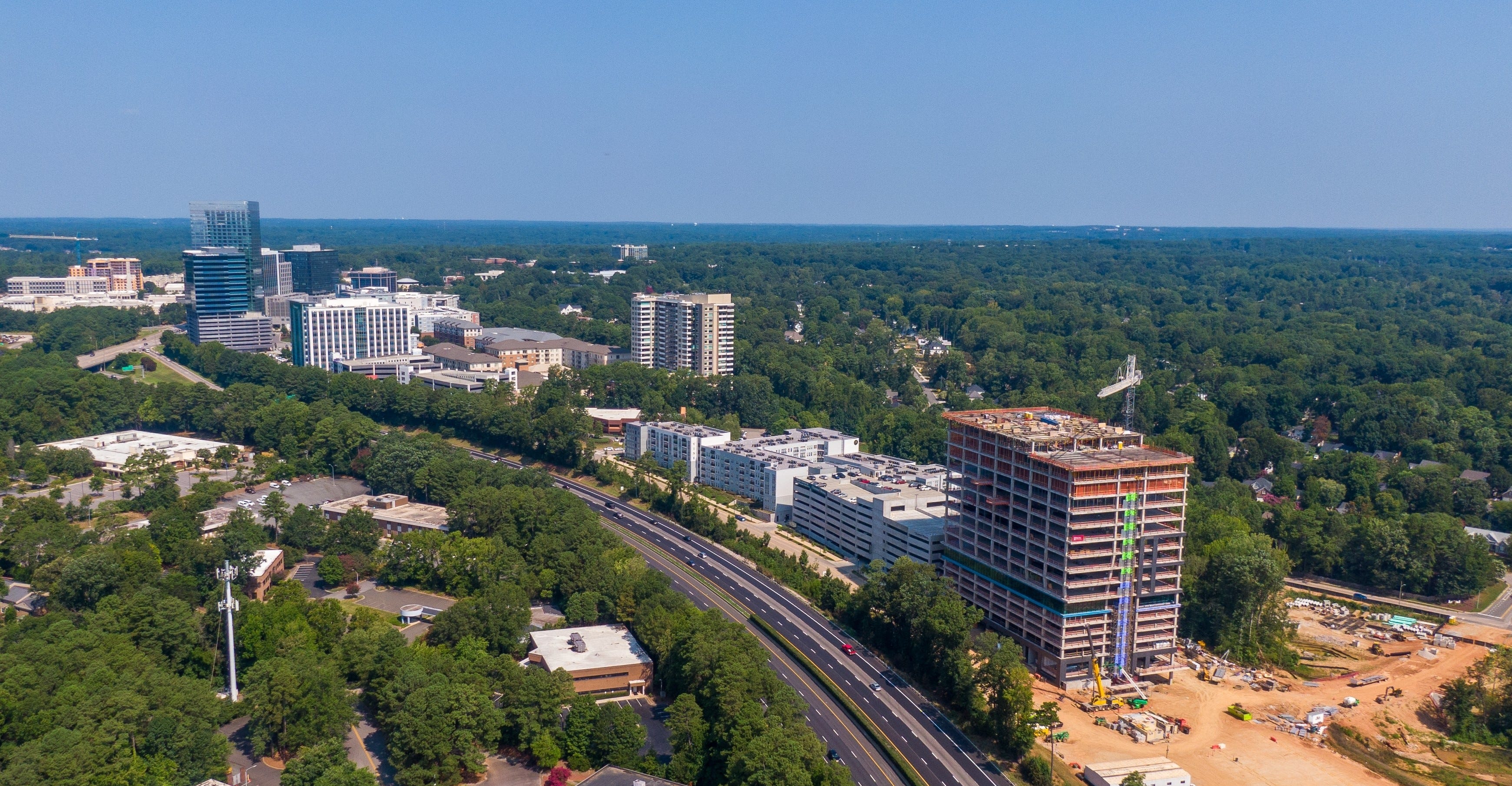
North Hills
In the late 1960s, North Hills Mall was converted into an enclosed mall, at the time the first two-story mall between Washington, DC and Atlanta. I wasn’t there when it opened, but not long after. Like many old school Raleighites, I remember eating at the K&W Cafeteria after church, racing down the concourses in my new shoes from Mobley’s, and spending time in the North Hills Branch of the Wake County Public Library.
In Raleigh in the 1970s, North Hills was considered North Raleigh, and North Raleigh was the edge of town - a destination you drove to, not through.
Today, that is certainly not the case. Including the surrounding neighborhood, North Hills is home to more than 35,000 residents. Offices, retail, and amenities bring tens of thousands of visitors each day, including thousands who work there every day. What was once peripheral now sits near the center of daily life. North Hills, now sometimes referred to as “Midtown”, has become a place where people live, work, and gather rather than simply a place they visit.
Somewhere along the way, the city changed around it.
How We Got Here
North Hills isn’t unique in this way. In the postwar era, cities across the country grew outward. Land was relatively inexpensive and widely available, and development patterns followed that abundance. Zoning separated housing, shopping, and working from one another. Connection was primarily by roads designed to move people efficiently between them. The automobile made this possible, allowing growth to expand beyond traditional centers while still remaining connected to them.
These assumptions worked when cities were expanding outward. But they began to change once growth turned inward.
As places like North Hills evolved, writers and planners began to describe how these development patterns were reshaping American cities. In Suburban Nation, Andrés Duany, Elizabeth Plater-Zyberk, and Jeff Speck described how separation of uses and auto-oriented growth produced environments organized around movement rather than proximity. At the time, these patterns reflected the priorities and possibilities of a country that was still expanding peripherally. But as cities matured, the assumptions behind them began to shift.
When Growth Turns Inward
In many places, that shift is now visible in real time. As cities grew, infrastructure served singular purposes. Roads moved cars from one place to another, greenways were recreation, and parks were amenities. Because land was plentiful, there was always room to build something else. It didn’t matter that infrastructure was specialized. Today, it does matter. As cities build within their existing footprint, specialization gives way to overlap.
Systems that once played supporting roles begin to carry more responsibility. Streets serve not only movement but access and gathering. Parks become part of daily routines rather than occasional destinations, and greenways are used for transportation. Walkability often emerges not from design alone, but from proximity - when the distance between daily needs becomes short enough that walking simply makes sense again.
Six Forks Road’s basic geometry from Wake Forest Road to Millbrook Road has not changed since the seventies even as traffic counts steadily increased. For decades, widening would have been the default response – measuring success by congestion relief and vehicle throughput. But the recent widening debate revealed something more complex. Questions of safety, crossings, multimodal access, neighborhood context, and cost began to weigh as heavily as traffic volume. What emerged was not simply disagreement over a project, but uncertainty about what streets in maturing areas are supposed to do.
In January, Raleigh City Council approved a rezoning request allowing significantly taller mixed-use buildings at North Hills. The proposal raised concerns about scale and congestion, particularly along Six Forks Road, and whether existing systems could support additional density. The discussion was less about a single project than about how much intensity belongs in places that were never originally intended to function as centers. What was once peripheral has become central, and central places carry different expectations.
The Triangle, like many regions, is increasingly polycentric. Raleigh’s 2030 Comprehensive Plan anticipated this shift, identifying mixed-use centers and corridors as the framework for future growth. As secondary districts take on primary roles, providing jobs, housing, and daily needs within closer reach, proximity itself begins to function as infrastructure, echoing what Carlos Moreno has described in “The 15-Minute City.” Transit investments such as Raleigh’s planned Bus Rapid Transit corridors reflect this same orientation - concentrating growth and mobility along existing corridors rather than assuming outward expansion.
The City of Oaks & Stewardship
Since its founding, Raleigh has been known as the City of Oaks. Early planners of the capital chose to preserve the existing, dense oak trees rather than clear them, incorporating them into the city’s design and streets. This preservation approach established a lasting, tree-filled, and green canopy landscape for which the city is still known today. In a nod to this legacy, a copper acorn is dropped at First Night to celebrate New Year’s Eve.
As cities shift to densification, the qualities people value most, shade, comfort, access to parks and open space, begin to require deliberate care. To help provide this care, Raleigh is in the process of initiating Leaf Out – an urban tree canopy and forestry initiative. Leaf Out aims to preserve canopy, reduce invasive species, promote native plantings - and plant 24,000 new trees by 2032, Raleigh’s 240th anniversary. At its core, Leaf Out reflects a framework for stewardship.
This maturing outlook extends beyond canopy and planting decisions. Parks, streets, and greenways begin to serve multiple purposes at once. Spaces once designed for occasional use become part of daily routines, carrying transportation, recreation, and social life simultaneously. The public realm, once taken for granted, becomes shared infrastructure. As density increases, issues such as heat mitigation, stormwater management, walkability, and well-being become more visible in daily life. Leaf Out, and similar programs, illustrate that well-established cities need care. The things that make cities livable no longer happen by accident.
Our outward growth assumed abundance, but inward growth requires stewardship.
In many cases, the shift is not to adding new or replacing old systems, but reevaluating how our current infrastructure is used. Greenways originally designed for recreation now serve as daily transportation routes for movement, reflecting how proximity changes expectations over time. Projects like the Triangle Bikeway represent the next step in that evolution - infrastructure designed from the outset to connect places that already exist.
What Comes Next
In some cases, infrastructure evolves gradually through changing patterns of use. In others, those changing patterns begin to shape infrastructure itself. Across the Triangle, the proposed Bikeway reflects this shift: an effort to intentionally connect places that have long existed separately, recognizing that mobility between established centers increasingly depends on connection rather than expansion.
The proposed Triangle Bikeway would create a 23-mile shared-use path linking Raleigh, Cary, Morrisville, RTP, Durham, and Chapel Hill, largely following the I-40/NC-54 corridor. It would stitch together existing greenways and bikeways while adding new segments designed for transportation as well as recreation - binding jobs, destinations, trail networks, and transit into a continuous regional system.
Historically in the Triangle, employment centers developed separately (downtown Raleigh, RTP, Durham, Chapel Hill) and movement between them assumed automobile travel. Distances were too long for traditional walking or cycling infrastructure.
The bikeway reflects a shift toward connecting existing centers rather than enabling new outward expansion. It aims to support short-to-medium trips between already developed places, overlapping recreation and transportation in the same corridor. The project explicitly aims to make trips for work, errands, and daily travel possible without a car.
Unlike many greenways that follow creeks or preserved corridors, the Triangle Bikeway is organized primarily around connection - linking jobs, destinations, and transit across the region while still supporting recreation along the way. In doing so, it treats proximity not as a byproduct of landscape, but as deliberate infrastructure. In places where similar ideas have had more time to evolve, efforts to reconnect existing infrastructure have begun to shape not only how people move, but how surrounding neighborhoods grow and change over time. Atlanta’s Beltline offers one example.
There are often common threads in ideas that emerge in different places. Similar to the origins of Raleigh’s greenway system, Atlanta’s Beltline began in the late 1990s as a Georgia Tech master’s thesis by Ryan Gravel, proposing that a network of former freight rail corridors be reconnected as a 22-mile loop of multi-use trails. The initial public framing emphasized connectivity, mobility, and public space. Over time, proximity to the trail reshaped how adjacent land was valued, turning adjacency into an asset. The vision grew beyond trails alone, imagining parks, green infrastructure, transit, and redevelopment organized around existing infrastructure rather than edge-of-town growth.
The Beltline has since become more than a transportation project. Early segments focused on trail access and public space, quickly becoming popular as recreational destinations. Over time, that success reshaped surrounding areas. Adaptive reuse projects such as Ponce City Market, the old Sears retail store, warehouse, and regional headquarters, emerged along the corridor, followed by new housing and commercial investment.
As property values increased, concerns around displacement brought affordable housing and equity into sharper focus, reflecting the complexities that often accompany reinvestment at this scale. To address this, the Atlanta Land Trust works with Atlanta Beltline, Inc. and Invest Atlanta to preserve affordable housing through a tax allocation district, reinvesting increases in property value into infrastructure, parks, and long-term affordability.
Still far from complete, the Beltline offers a glimpse into how reinvestment in existing infrastructure can gradually reshape cities over time. Its evolution illustrates how public space, mobility, and development begin to intersect as growth re-centers, revealing possibilities that emerge when existing places are reimagined rather than expanded. In many ways, projects like the Beltline reflect the same broader pattern seen in places like North Hills; areas once shaped by a different era gradually finding new purpose and life as cities grow around them rather than beyond them.
What Maturity Feels Like
As cities shift from outward expansion to urban intensification, the public realm takes on greater importance. Parks, streets, tree canopy, and shared corridors become the places where daily life overlaps and collective responsibility becomes visible. Projects such as the redevelopment of the old NCDMV Headquarters site or the long-term vision for Dix Park reflect this shift - efforts that recognize the value of shaping existing places rather than extending outward. The measure of growth may no longer be how far a city extends, but how well it shapes what it already holds in common.
The shift is not complete, and it is not without friction, but it is underway. As Raleigh matures, these questions are no longer confined to corridors and secondary centers. They are beginning to surface in the city’s oldest civic spaces as well - including Nash Square, where a historic public landscape is now being reconsidered in the context of a changing downtown.
What does growth mean when expansion is no longer the default?